

Automating the mapping of dunes…
If the image of the cartographer or geologist carrying out manual surveys in the field is not yet a thing of the past, high-definition imagery and artificial intelligence are profoundly changing their research methodologies and practices.
Would mapping dunes “by hand” not be a “subjective” act, even when we are assisted by our computers? Paul Bessin, a lecturer and researcher in geosciences, answers “yes” without hesitation: “It’s a thought that often crosses our minds. We’re told that in the field, we see what we want to see. What’s more, applying traditional techniques takes an age. ”Will artificial intelligence therefore prove to be more objective? Part of the answer will be available in a few months’ time, through the results of the CALEPAB and BEDFORMAP projects, led by the LPG and the Geomatics and Land Registry Laboratory (GeF).
For the past two years, the “Laboratoire de Planetologie et Géosciences” has been supervising a PhD thesis on the automation of dune mapping, with the aim of “working faster, covering larger areas, and using objective criteria such as slope and shape,” the researcher adds.
Dunes are formed through the interaction between a flowing fluid – in this case, air – and the amount of sand available. The data is sourced from satellite imagery and high-resolution topographical data (up to 1 pixel per metre), and is processed using artificial intelligence and deep learning. And whilst the uninitiated might think that dunes are merely continuous, or even indeterminate, features, specialists are able to characterise their contours and crest lines.
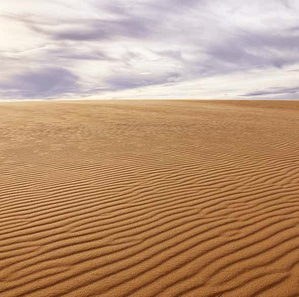
“We can even study the small dunes situated on top of the larger dunes,” explains Paul Bessin. For example, the researchers plan to return, equipped with drones, to the Dune du Pyla to study the smallest dunes, known as ripples, which measure just one centimetre high by four centimetres wide. These ripples are proving a real challenge. Currently, no tool is capable of mapping them reliably.
“As for large areas, such as deserts, for example, the dunes there are often layered and complex.”
Through the project, the researchers aim to understand how the dunes ‘organise’ themselves, how smaller dunes “feed” (or do not feed) the larger ones, and how they can be classified in relation to one another.
If they succeed in establishing a sufficiently robust mapping method, they will then be able to track the evolution of dune fields over time.
Jimmy Daynac, a PhD student at Le Mans University, has already mapped the dunes across the entire Arabian Peninsula—which covers approximately 3 million km²—at various scales ranging from 100 metres wide to spacings of 2.4 or 6 km between dunes.
This would have been impossible to achieve manually. In the context of current climate change, the usefulness of such a tool is clear for dynamically monitoring the evolution of areas affected by desertification, thanks to data updates every month, or even every day, particularly in sub-Saharan Africa. In which directions are the dunes moving? At what speed? How is their morphology changing? “Dunes are dynamic and can move quickly,” warns Paul Bessin, “hence the importance of collecting data acquired over short periods.”
Another potential application of this method is to ensure the correct positioning of offshore wind turbines and tidal turbines. Indeed, these machines are often placed on underwater dunes for convenience, as in the English Channel, for example.
“However, if the underwater dune shifts, the base of the wind turbine may end up above the seabed. Experts and companies therefore need to know where and how these dunes are moving,” explains Paul Bessin. But, in this field as in others, artificial intelligence and automation will not be able to fully replace human expertise. “The decision-making process followed by the machine must be clear and must not contain any errors from the outset.”
>Article published by the Science & Society Centre at Le Mans University
Published on February 18th, 2026